
Expertise
My professional expertise can be summarised in eight key areas, which include both topic-specific expertise — like geospatial data, data sharing & digital transformation - and several cross-cutting domains, such as capacity building, research and innovation. 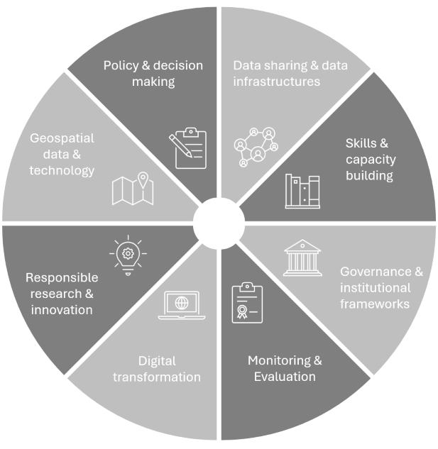
Geospatial data & technology
Geospatial data and technologies have been at the core of my work, since the early stages of my career. My experience spans from examining the value of geospatial data over identifying and describing key topics related to GIS&T to supporting the collection, management, use and sharing of geospatial data.
Projects in this area include:
- ELISE 2020 - Leveraging the power of location information and technologies to improve public services at local level (2020-2021)
- Elaboration of standards, norms and procedures in the acquisition and dissemination of geospatial information in Mozambique (2019-2020)
- GI-N2K – Geographic Information Need to Know (2013-2016)
Relevant publications include:
- European Commission: Joint Research Centre, Vancauwenberghe, G. and Hernández Quirós, L. (2022). Evolution of the access to spatial data for environmental purposes – A study on the past, present and future of spatial data infrastructures in Europe. Luxembourg: Publications Office of the European Union.
- European Commission: Joint Research Centre, Nasi, G. Buongiorno S. C., et. al. (2022). Leveraging the power of location information and technologies to improve public services at local level – Case study analysis. Luxembourg: Publications Office of the European Union.
- Vancauwenberghe, G., F. Welle Donker, & van Loenen, B. (2018) Business Models for Geographic Information. In: J. Brown Kruse, J. Crompvoets, and F. Pearlman (Eds.), GEOValue; The Socioeconomic Value of Geospatial Information. Boca Raton (US): CRC Press, pp. 85-115.
Data sharing & data infrastructures
Data sharing is a key area of focus in my work, with a particular emphasis on setting up effective data infrastructures and supporting sustainable data ecosystems. I have been working on promoting data transparency and data sharing, developing licensing models and business models and optimizing legal & institutional frameworks for effective data sharing.
Illustrative projects in this area include:
- USAGE – Urban Data Space for Green Deal (2022-2025)
- ODECO – Towards a sustainable Open Data ECOsystem (2021-2025)
- Towards an Open Spatial Data Infrastructure in Peru (2019-2020)
Relevant publications include:
- Schade, S., Granell, C., Vancauwenberghe, G., Keßler, C., Vandenbroucke, D., Masser, I., & Gould, M. (2020). Geospatial Information Infrastructures. In: Huadong, G., Goodchild, M.F. & Annoni, A. (Eds.), Manual of Digital Earth. Singapore: Springer, pp. 161–190
- Van Loenen, B., Vancauwenberghe, G., & Crompvoets, J. (2018). Open Data Exposed. Information Technology and Law Series, vol. 30. The Hague: TMC Asser Press.
- Vancauwenberghe, G., Dessers, E., Crompvoets, J., & Vandenbroucke, D. (2014). Realizing Data Sharing: The Role of Spatial Data Infrastructures. In: Gascó-Hernández M. (Eds.), Open Government. Opportunities and Challenges for Public Governance. New York: Springer, 155-169
Governance & institutional frameworks
Building on my background in public administration research, I have gained expertise in governance and institutional frameworks. This allows me to investigate and evaluate governance & institutional frameworks in place, and to support governments and organisations in shaping effective governance structures.
Project examples in this area are:
- International Lessons Learned and Recommendations on Business and Funding Models for Mekong Delta Center (2021-2022)
- Effective Governance of Open Spatial Data (2016-2018)
- SPATIALIST - SDI for Public Sector Innovation (2007-2011)
Relevant publications include:
- Vancauwenberghe, G., & van Loenen, B. (2019). Governing Open Spatial Data Infrastructures: The Case of the United Kingdom. In: Rodríguez Bolívar M., Bwalya K., Reddick C. (Eds.), Governance Models for Creating Public Value in Open Data Initiatives. Public Administration and Information Technology, vol 31. Springer, Champ, pp. 33-54.
- Crompvoets, J., Vancauwenberghe, G., Ho, S., Masser, I., & de Vries, W. T. (2018). Governance of national spatial data infrastructures in Europe. International Journal of Spatial Data Infrastructures Research, 13.International Journal of Spatial Data Infrastructures Research, 13.
- Vancauwenberghe, G. (2013). Coordination within the Spatial Data Infrastructure: An analysis of the exchange and use of geographic information in Flanders (Belgium). PhD Thesis. KU Leuven: Leuven
Digital transformation
Initially focused on the role of geospatial data and data infrastructures in digital transformation, I have broadened my expertise to encompass all aspects of digital transformation. This includes driving innovation through emerging technologies, fostering organizational change, and implementing data-driven strategies.
This area of expertise is demonstrated in projects such as:
- DIS4SME - Data Interoperability Skills for SMEs (2023-2024)
- ELISE Knowledge Transfer: Location Interoperability for Digital Transformation (2019-2020)
- The role of the Spatial Data Infrastructure in the Digital Transformation of Public Administration (2018-2019)
Relevant publications include:
- European Commission: Joint Research Centre, Vandenbroucke , D., Vancauwenberghe, G., Boguslawski, R., Pignatelli, F. (2020). Design of location-enabled e-government services. Luxembourg: Publications Office of the European Union.
- European Commission: Joint Research Centre, Barbero, M., Lopez Potes M., Vancauwenberghe G., & Vandenbroucke D. (2019). The role of Spatial Data Infrastructures in the Digital Government Transformation of Public Administrations. Luxembourg: Publications Office of the European Union.
- Crompvoets, J., Vancauwenberghe, G., Bouckaert, G., & Vandenbroucke, D. (2010). Practices to develop Spatial Data Infrastructures: Exploring the contribution to E-government. In: Practical Studies in E-Government, Chapt. 13. New York: Springer, 229-248.
Policy & decision making
I have been supporting government organizations worldwide across various stages of the policy process, including design, formulation, implementation, and evaluation. This includes providing support in drafting policy and strategic documents, identifying and evaluating policy options, and engaging stakeholders in the policy process through co-creation.
Examples of projects in this area are:
- Consultancy for the Development of NSDI Policy Documents in Georgia (2024-2025)
- Support to Space Traffic Management Standardisation (2022-2024)
- INSPIRE Strategy Romania (2014-2015)
Relevant publications include:
- Vancauwenberghe, G. (2024). Guidelines for policy co-design processes - Second Version. USAGE - Project Deliverable 2.5.
- Vancauwenberghe, G., Vandenbroucke, D., Crompvoets, J., Pignatelli, F., & Boguslawski, R. (2014). Assessment of the integration of geographic information in e-government policy in Europe. In: Proceedings of the AGILE’2014 International Conference on Geographic Information Science,. AGILE Conference on Geographic Information Science. Castellón, Spain, 3-6 June 2014.
- Vancauwenberghe, G., Crompvoets, J., & Vandenbroucke, D. (2013). Location information strategies: bringing location into e-government. In: Anthopoulos L., Reddick C. (Eds.), Government e-Strategic Planning and Management. New York: Springer, 65-82.
Skills & capacity building
Skills and capacity building is a central focus of my work, aimed at strengthening individual and organisational capabilities. My work includes mapping existing training offers, assessing skills needs and gaps, and designing tailored educational and training responses. I am involved in the full cycle of capacity development—from analysing needs and desiging curricula to preparing learning activities and and delivering training.
Examples from my work in this area include:
- SEED4NA - Spatial Data Infrastructures and Earth Observation Education and Training for North-Africa (2020-2024)
- giCASES - Creating a University-Enterprise Alliance for a Spatially Enabled Society (2015-2016)
- EO4GEO - Towards an innovative strategy for skills development and capacity building in the space and geo-information sector to support Copernicus user uptake (2018-2022)
Relevant publications include:
- Vancauwenberghe, G. & Lacroix, L. (2023). Specification of project curriculum in SDI and EO. SEED4NA Project Deliverable 1.4.
- Vancauwenberghe, G., Thiru, N., & Vandenbroucke, D. (2023). Trends and challenges on location data interoperability education and training. DIS4SME - Project Deliverable 2.1.
- Gruijthuijsen, W., Pontes, S., Vancauwenberghe, G., Vandenbroucke, D., & Olijslagers, M. (2019). Understanding skill needs in the EO/GI sector: A job advertisements analysis. 22nd AGILE Conference on Geo-information Science, Limassol, Cyprus, 17-20 June 2019.
Monitoring & evaluation
Monitoring and evaluation (M&E) is another dedicated area of my expertise, focused on assessing the performance and impact of policies, programmes, and projects. I support the development of tailored M&E frameworks, combining qualitative and quantitative methods to generate accurate and actionable insights.
This expertise is reflected in projects such as:
- Impact Assessment for the new EU Space Law (2023-2024)
- The costs and benefits of geospatial web services of the national Spanish SDI-node (2020-2021)
- Feasibility studies on the added value of remote sensing technologies in EU development cooperation projects (2019-2020)
Relevant publications include:
- Vancauwenberghe, G. (2024). NSDI Monitoring & Evaluation Methodology. Consulting Services to supporting NSDI Action Plan and Business Model Implementation - Deliverable 2.1..
- Vancauwenberghe, G., Valečkaitė, K., van Loenen, B. & Welle Donker, F. (2018). Assessing the Openness of Spatial Data Infrastructures: Towards a Map of Open SDI. International Journal of Spatial Data Infrastructures Research, 13.
- European Commission: Joint Research Centre, Vandenbroucke, D., Vancauwenberghe, G., Crompvoets, J., Pignatelli, F., Smits, P., Boguslawski, R., Vowles, G., Borzacchiello, M.T. (2014). Assessment of the Conditions for a European Union Location Framework. Luxembourg: Publications Office of the European Union.
Responsible research & innovation
With a strong belief in the importance of research as a driver of positive change, I have developed expertise in responsible research and innovation (RRI). In designing, conducting, and disseminating research, I aim to ensure that outcomes are not only scientifically rigorous but also socially relevant, ethical, and sustainable.
Relevant project examples include:
- Copernicus Service Component R&D needs collection and analysis for Horizon Europe and stakeholder consultation (2019)
- CENTRIC – Centre of Excellence in Territorial management and Cadastre (European Commission – Horizon 2020 Teaming) - Senior GI Expert
- SmeSpire - A European Community of SMEs built on Environmental Digital Content and Languages (2012-2014)
Relevant publications include:
- Vancauwenberghe, G., & van Loenen, B. (2018). SDI Research and Strategies towards 2030: Renewing the SDI Research Agenda. AGILE 2018 Pre-conference Workshop Report. Delft: TU Delft.
- Van Loenen, B., Zuiderwijk, A., Vancauwenberghe, G., Lopez-Pellicer, F. J., Mulder, I., Alexopoulos, C., Magnussen, R., Saddiqa, M., Dulong de Rosnay, M., Crompvoets, J., Polini, A., Re, B., & Casiano Flores, C. (2021). Towards value-creating and sustainable open data ecosystems: A comparative case study and a research agenda. JeDEM - EJournal of EDemocracy and Open Government, 13(2), 1–27.
- Cipriano, P., Easton, C., Roglia, E., Vancauwenberghe, G. (2013). Study on the Geo-ICT sector in Europe. SmeSpire.
Most of the projects and publications mentioned cut across multiple areas of expertise. Detailed descriptions of these projects can be accessed via Projects. An overview of the publications is available here.