
SPIDER - Open Spatial Data Infrastructure Education Network (2020-2022)
The main objective of the SPIDER project was to promote and strengthen active learning and teaching towards Open SDI. More specific objectives of the project were 1) to explore, develop and implement the concept of Open SDI as a new paradigm to SDI education; 2) to promote and facilitate active and multidisciplinary learning and teaching on Open SDI; and 3) to drive the exchange and update of Open SDI teaching and learning resources by teachers and students.
One of the key project outputs contributing to achieving these objectives was the Mapping of SDI Education in Europe. This mapping of SDI Education in Europe explored and investigated the existing offer of academic education on SDI in Europe , and identified the actors currently involved and topics covered in SDI education. The mapping of SDI Education provides an in depth description and investigation of existing courses on SDI , collecting and analysing information on the programs in which SDI education is included, the topics addressed, the learning objectives and the teaching and learning activities that are adopted. 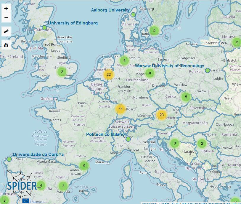
The information on these courses was made available through the online Map of SDI Education. The first version of this map included 126 different courses, from 63 different higher education institutions in Europe, in 22 different countries. For each course, information was collected and made available on the course name, university, country, tutor(s) involved, credits, languages, programme, course content, learning objectives and course methods. This allowed us to investigate and compare different courses related to SDIs. 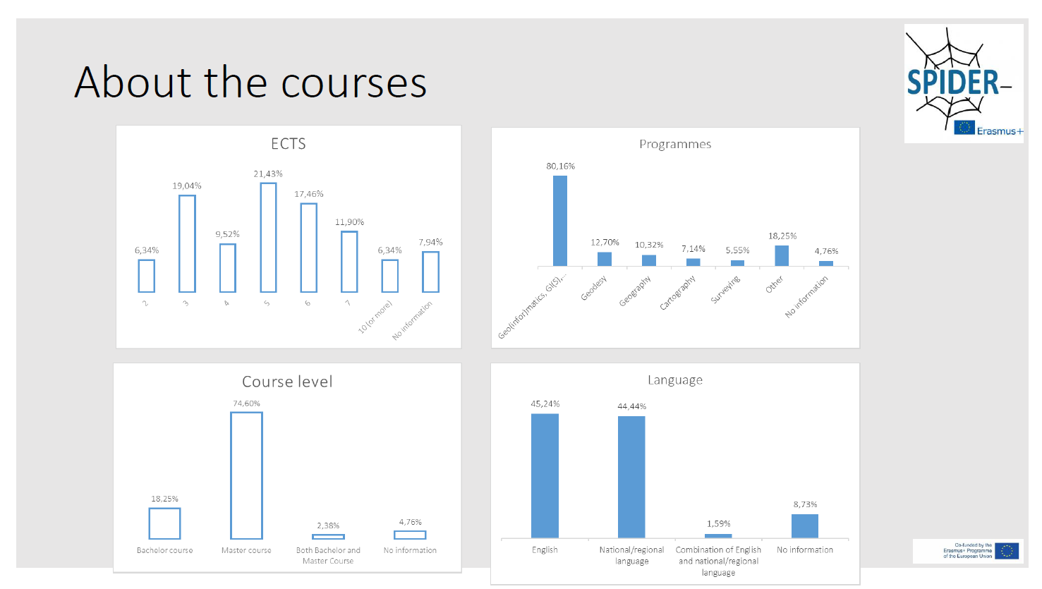
Six main groups of SDI-courses were identified:
- Spatial Data Infrastructures (22 courses): e.g. Spatial data Infrastructure, Geodata Infrastructures, Geoinformation Infrastructure, Geospatial infrastructures, Spatial Information Infrastructures, Information Infrastructures, Open GIS & SDI, SDI Services Implementation, SDI and Standardization, Database engineering, SDI and web mapping
- Online/web services (40 courses): e.g. Web GIS, Web and Mobile GIS, Web Mapping, Internet GIS, Web Processing services, WebStandards in Geoinformatics, Web service - GIS interfaces, WebGIS and Geoprocessing, Web-GIS technologies, Development of Web GIS Applications, Thematic and Web Cartography
- Data(bases) & data management (32 courses): e.g. Geodata Management, Geodatabases, Databases, Geographic Data Management, Geographic Databases and Geospatial Web Services, Geospatial data, Data formats and interfaces, Design of Geospatial Data Models, Geospatial base data, Geodata Integration
- Standards & interoperability (13 courses): e.g. GI-Standards, Geo-informatics, Interoperability, GIS (Standards Services), Norms and Standards, Open GIS, Standards, Architectures and Services, Spatial Data Infrastructure and Standardization, Standards & Interoperability, Terms and Standards in Geoinformatics, Web Standards in Geoinformatics
- Legal/organisational/policy/governance aspects (6 courses): e.g. Geo-information Organisation and Legislation, Legal & Social Aspects, Management in Organisations, Geoinformatics in Public Administration, European aspects of GI, GIS in Organizations
- GI, GIS, Geospatial, GI Technology (32 courses): e.g. Advanced geoinformatics, Advanced GIS, Application of OpenSource GIS, Cartography, GIS and Land Information Infrastructures, Dissemination of GI, Extraction, Analysis and Dissemination of Geospatial Information, Geographic Information Systems 2 Geographical Information Platforms